 Perhaps you are a casual walker who has toyed with the idea of doing something bigger, perhaps walking a trail that seems too long to complete, like the 237-mile KATY trail that extends almost across Missouri. If you need a bit of encouragement, read on.
When the KATY trail was born in the early 1990s, I remember thinking that it might be fun to attempt someday to walk and explore at least some of the trail. But being employed full-time with a family of three active boys, I put that thought in the back of my mind for contemplation some other day.
I broached the subject with my family, who promptly replied, “Are you thinking of walking the whole thing?” I was now almost 70, and while I almost daily walked the neighborhood for a mile or so every day, walking even five miles in a stretch was not something I was sure I could sustain. I answered, “Well, I don’t think so, but it might be fun to do part of it.”
I live in Kansas City, and the trail for me “begins” in Clinton, 55 miles away. There was also the matter of logistics: how do I get to the trail, where do I start, where do I end, are there places to stay, how far can I walk in a day, what will I need, what kind of footwear will I need and how long will it take? Like most people who contemplate doing something like this, I initially envisioned starting at one end of the trail and walking until I reached the other. Lots of questions gradually formed answers as I decided to walk at least a part of it and then worked out the answers as I proceeded. So, if you’re contemplating walking all or part of the trail, perhaps you’ll find some answers in the steps I took to complete the entire trail eventually.
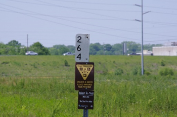 First, the basics. While walking the trail sounded interesting, I had never even visited the trail, so I convinced my wife and oldest son to take a car ride with me and at least visit parts of the trail from Clinton to Sedalia, a stretch that I decided I would attempt first. Visiting the trailheads and parts of the trail in some of those towns in the early spring, we all found the trail to be what was advertised; generally flat with a small pebble rock base and what looked to be lots of trees overhanging the walkway. Once the family visited the trail, they got interested and were happy to offer me assistance driving to and from the towns if I needed transportation, both starting a section of trail and ending a section of trail, for I was beginning to decide that I would probably try walking a section a day and then returning another day to walk another section. While some people do walk the trail in one continuous walk, from beginning to end, I decided that would not be practical for me. Also, by visiting the trailheads and reading the information signs, I started to get an idea of the nominal length between trailheads, and that would be the distance I needed to train for if I were to be successful. And walking the sections in non-sequential order to complete the whole trail is valid and gives you options on which section you may want to walk at any given time or season. For instance, I chose to walk the Rocheport-to-McBaine section during the late fall when the leaves would be in their fall colors.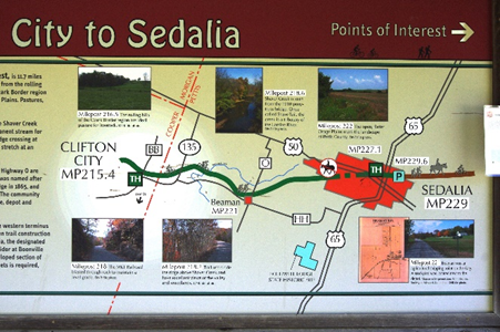
Shoes were the next item. Having never been a professional hiker, I visited a reputable nearby shoe store and asked the clerk for recommendations. We settled on a pair of leather New Balance shoes that were very comfortable, and we made sure they fit my feet properly. I never had an issue using that pair of shoes for the entire trail. I broke them in by “practice walking” the month before I set out on the trail in earnest. The last thing you want when walking long distances is blisters on your feet!
The next thing I decided to do was find a place to “practice walking” the distances that mimicked the trail. I chose the Longview Lake trail in Kansas City, about seven miles from home. It has a similar track, is marked every two-tenth of a mile, and is long enough to eventually walk a ten-mile length and still return home when I finished. I found that an average trailhead-to-trailhead length was approximately 11-12 miles. Some are shorter, but a couple is 15 miles, so I decided that if I could walk ten miles, I would probably be able to walk any distance required.
I began in April of 2017 to “practice walking” in anticipation of beginning my KATY trail journey in May. I would drive to the lake and begin my first walk, limited to four miles. During that month, I would return several times weekly and increase the length by a mile or two daily. Eventually, I walked the ten miles I had envisioned. During these walks, I carried my camera and a backpack with water, spare socks, and other items I felt would be necessary on the trail. I also found that I normally walk about three miles in an hour, stop after every three miles, and rest for about ten minutes, taking off both my shoes and socks and letting my feet “breathe.” That stipulation I continued during my KATY trail walks, which always relieved me and my feet. The final thing the practice walks told me was how long it would take to complete an average walk of 10-12 miles.
Since I decided to walk a section a day (trailhead-to-trailhead), I began to plan and enlist help for getting to the starting trailhead and how to return home from the ending trailhead at the end the day. Eventually, as the sections of the trail got further away from home, I would find a bed-and-breakfast inn along the trail and then planned several two-day walks where I negotiated with the owner of the bed-and-breakfast to pick me up at the end trailhead of my planned walk and then drive me to the beginning trailhead which meant that the bed-and-breakfast would be somewhere approximately in the middle. I found that the bed-and-breakfast owners are very gracious in doing this service, and I always made arrangements at least a week in advance and paid them for their services. Also, a note is in order here. The trail is very busy during the summer, and these places can fill up fast. The sooner you contact the owner about your proposed arrangements, the better your chance of obtaining a room and a ride!
I began walking the trail on May 9th, 2017, and completed the walk on May 11th, 2018. The walk was split into two “legs,” with the first leg completed the first year and the second leg completed the second year. I completed the trail from Clinton to McKittrick (Hermann) in 2017 for my first leg and finished the second leg from McKittrick to St. Charles in 2018. The reason for this was that I tried to only walk during good weather, not too hot or not too cold. Some parts of the trail are not shaded and can be brutal in hot weather. Also, the trails’ bathrooms are usually not open until April and closed in November. That’s important for a walker because there are no other restroom facilities on the trail, and a 12-mile walk may take upwards of five hours. Also, the trail from McKittrick-to-St. Charles is closer to St. Louis, and walking that section required a strategy that put me in the St. Louis area for the final push to finish.
In 2017 I walked for 15 days, beginning in Clinton. I walked in May, June, September, and October because the weather was mild. I also walked on July 31st because the weather was conducive. I tried to plan around rain and was largely successful, as I was only rained on during one walk, even though that day was supposed to be sunny. My last walk in 2017 was October 26th, and as I mentioned, I wanted to see the fall foliage between Rocheport and McBaine, which follows the bluffs along the Missouri River.
McKittrick is about 71 miles from St. Charles. I calculated it would take about six days to complete, which I decided to do in continuous days of walking because we would be staying in the St. Louis area. So, in May 2018, I enlisted my wife's help to complete the KATY trail walk. Luckily, we have family in the St. Louis area, so we utilized this time also to visit them. We booked a motel in Chesterfield which became my wife’s “home” for a few days while I finished the trail. For the last four days of my walk, she would drop me off and pick me up at the various trailheads.
As you probably have discerned, I relied heavily on my family to help me accomplish this walk. However, once I started this endeavor, they became solidly behind me and encouraged me to continue; at times, the endeavor seemed to become a “slog.” I am also very grateful to my Jefferson City friends for helping me out and to the B&B owners who went out of their way to assist me. I especially want to commend Jerry at the Katy Junction B&B in Pilot Grove, who even dried my clothes after I got caught in the rain on my walk, and Kenny and Missy Stevens, owners of the Doll House B&B in Rhineland, who most graciously assisted me twice in picking me up at one trailhead and dropping me off at another.
Finally, some other things probably should be pointed out.
1. Shade: The trail is generally shady, but some long stretches are not. The Clinton to Calhoun stretch is one of them, and parts parallel Highway 52.
2. Trail: The trail is generally flat, but some long stretches also gradually incline.
3. Noise: No matter where you walk, there is always some man-made noise, such as airplanes, vehicles, and (especially irritating) motorcycles. Even the most remote part of the trail from Rocheport to Jefferson City is not immune.
4. Internet: Most of the trail has Internet access, which is handy as I could usually find my location using Google Maps. The trail between Rocheport and Jefferson City probably has the least cellular accessibility because of its remoteness. I utilized Verizon and an Iphone-7+.
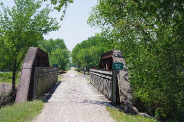
5. Benches: Benches are few on the trail unless you’re close to a trailhead. Generally, more benches are on the trail closer to the larger towns like Sedalia. (Note: I discovered that a bridge worked well in place of a bench when I stopped for my breaks.)
 6. Bathrooms: As mentioned previously, there are no bathrooms on the trail except at trailheads, most of which are porta-potties.
7. Bikers: Bikers “own” the trail, and depending on where you are and what day of the week, you will see many more bikers than walkers. The exception is large towns where many locals walk (and run) the trails. Weekends are the busiest. Generally, bikers are very friendly and helpful. More than once, while taking a break, a biker asked if I needed help. The trail from Clinton to Sedalia and Tebbetts to Portland also allows horses, but I didn’t encounter any during my walk, probably because most of my walks were on weekdays.
8. Missouri Parks Department: (https://mostateparks.com/park/katy-trail-state-park) Before you go, familiarize yourself with the Missouri Parks Department's general guidelines. They have lots of good information regarding what to carry, etc., and they also give trail condition updates. They do not recommend walking alone, but I did that because I couldn’t find a partner who met my schedule or had the time available. However, someone in my family always knew where I would walk and the approximate time to complete my walk. Also, that is another reason to keep a cell phone handy.
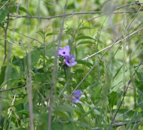
9. Seasons: I walked both spring and fall and discovered that I preferred spring because of the animal activity and the spring flowers. I enjoyed the fall colors, but by then, many animal species were migrating, and the mating season was complete for most.
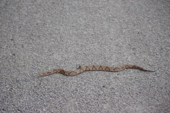
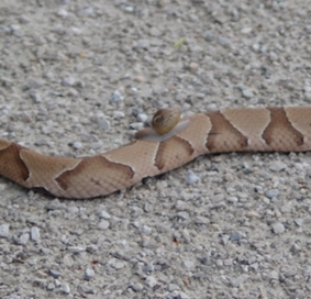
10. Camera: I love animal and plant photography, and there are numerous opportunities to photograph both. You never know what’s around the corner. Just after I stopped to eat one day, a deer stepped onto the trail less than 50 yards away from me. Another time I found a four-foot copperhead snake sunning itself on the trail (I took a WIDE berth.) However, when looking at the pictures I took of him, I later discovered that he had a snail attached to him, hitching a free ride!
11. Backpack: I carried a backpack with minimal items to keep the weight down. I carried a KATY trail map, a first-aid kit, a whistle, a charging battery and cable, spare socks, a small towel, a backup camera battery, a snack and/or sandwich, and enough water to last for the time I estimated that I would be on the trail. I also carried sunglasses and a visor which I normally wore. The small towel was useful for wiping off my face as I sweat. (Note: After hiking 12 miles with a backpack on, I gained a new appreciation for the Civil War soldiers who were asked to walk for 25 miles over uneven terrain with a full knapsack and then fight a battle!)
12. Bugs: When walking, you will be pestered by gnats as they are attracted by your sweat and fly directly in front of your face. Another reason sunglasses are essential! Also, occasionally large bees fly around you, making an unmistakable buzzing sound. I just continued walking; they never landed on me and usually left after a minute.
13. Sedalia: There is an oddity about the trail in Sedalia. The trail from Green Ridge to Sedalia ends at an excellent trailhead in downtown Sedalia. However, going on to Clifton City, the trail meanders through the city and onto a road where it finally becomes the actual trail again. For some reason, I never found this out, and when my brother-in-law dropped me off, it was at the location of the original train track, which I discovered, had not been converted. Nevertheless, I also walked this section for about a mile when I returned to the completed section of the trail.
14. Bed & Breakfast facilities: I stayed at four different B&Bs during my walk and found most very pleasant and helpful. (The one exception is the now-closed. Little House B&B was pleasant enough, but the owner only rented it out to one person at a time, and breakfast was a laid-out assortment of cereals, pastries, etc.). Dinner was always on-your-own, so I ensured there was at least one restaurant somewhere easy to walk to, as well as the B&B itself. Unlike a biker, you’re limited in how far you can reasonably go, and after a long hike, you don’t want to walk very far! Breakfast was always plentiful; as mentioned before, the owners were there for our assistance and comfort. (The owners would take my change of clothing to the B&B after dropping me off and allow me to return and pick these items up after completing my walk the next day. This negated the need to put everything in my backpack.) The KATY trail website (https://bikekatytrail.com/mileage-chart.aspx) has excellent information about everything from mileage between trailheads to amenities at each trailhead.
15. Odds & Ends: If you’re wondering, the final tally of the steps I took to complete the entire trail was around 450,000. I kept a log on my phone of steps, number, and approximate placement of benches, the general condition of the trail I took that day (level, shady, uphill, etc.), and how shady or open it was and gave it a rating of 1-10. I also carried an SLR camera with a telephoto lens. I find this much better than a phone for close-up shots, although the new phones will capture most animals and plants well.